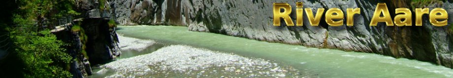
The river Aar, Gorge of the Aar, between Innertkirchen and Meiringen, Switzerland
|
|
|
The source of the Aar
The river Aar (German : Aare) is the main tributary of the river Rhine. The source of the river Aar is situated in the Grimsel massif, in the Bernese Oberland. The nearest place is Guttannen.Oberaar Glacier
The Upper Aar Glacier (German: Oberaargletscher) is feeding a reservoir, the Lake Oberaar (German: Oberaarsee) west of the Grimsel pass.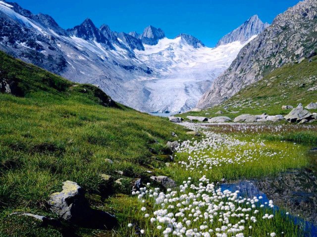
Oberaar glacier. Left: Roosseehörner and Roosseejoch 3132m, Oberaarrothorn 3477m, Nollen 3402m, Right: Oberaarjoch and Oberaarhorn. 23 August 2007.
Unteraar Glacier
The Lower Aar Glacier (German: Unteraargletscher), being the continuation of the the Finsteraar Glacier and the Lauteraar Glacier, represents a much larger volume of ice than the Oberaar Glacier. It's no wonder that the Unteraar Glacier contributes a larger part to the river Aar. The Unteraar Glacier is feeding the Lake Grimsel. Thus the Unteraar Glacier is the main source of the river Aar waters, while the Oberaar Glacier and the Oberaarbach could rather be seen as a tributary of the Aar.
Glaciers and lakes of the Grimsel massif seen from Sidelhorn (2764 m). Left: Lake Oberaar, Oberaar glacier and Trübtensee, Right: Lake Grimsel and Unteraar glacier. Summits: the Finsteraarhorn (4274 m), the Schreckhorn (4078 m) and the Lauteraarhorn (4042 m). 11 September 2010.
Lake Oberaarsee
The reservoir Oberaarsee is located at 46°33′N 8°16′E at the altitude of 2303 m. The lake is 2.8 km long, 90m deep and covers a surface of 1.47 km2, The dam has been completed in 1953.The inflow of the lake Oberaar is the Oberaar glacier. The outflow of the lake Oberaar is called Oberaarbach and is feeding another reservoir, the lake Grimsel (German: Grimselsee).
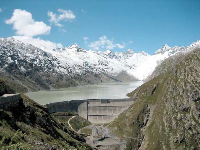
Oberaar dam, Lake Oberaar and Oberaar glacier near Grimselpass, Bernese Oberland, Switzerland. Left: Geschinerstock 2856m, Blatthörner 3040m, Löffelhorn 3095m, Roosseehörner and Roosseejoch 3132m, Oberaarrothorn 3477m, Nollen 3402m, Right: Oberaarjoch and Oberaarhorn. 15 August 2006.
Lake Grimselsee
The reservoir Grimselsee is located at 46°34′N 8°19′E at the altitude of 1908 m. The lake is 5.3 km long, 100m deep and covers a surface of 2.72 km2, The construction has been completed in 1932. The reservoir Grimselsee is special since it has 2 dams, a straight gravity dam and an arch dam.The inflows of the lake Grimsel are the Unteraar glacier and the Oberaarbach coming from lake Oberaar. The outflow of the lake Grimsel is the river Aar which feeds an other reservoir, the Raeterichsbodensee just afterwards.
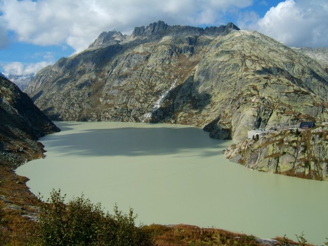
Lake Grimsel seen from the road between lake Grimsel and Grimsel pass. 29 September 2006.
Photographer: T. Demand
License: CCbysa
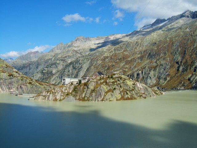
Grimsel Hospice and Lake Grimsel with high water level at the end of September. On the left: the curved dam, on the right: the straight dam. 29 September 2006.
Photographer: T. Demand
License: CCbysa
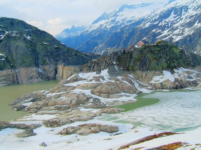
Grimsel Hospice and Lake Grimsel with low water level in early June. 8 June 2006.
Photographer: T. Demand
License: CCbysa
Lake Raeterichsbodensee
The reservoir Raeterichsbodensee is located at 46°35′N 8°19′E at the altitude of 1767 m. The lake is 1.7 km long, 77m deep and covers a surface of 0.67 km2, The dam has been completed in 1950.The inflow of the lake Raeterichsbodensee is the river Aar coming from lake Grimsel. The outflow of lake Raeterichsbodensee is the river Aar flowing down in direction of the Aar Gorge.
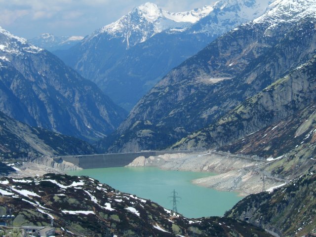
Lake Raeterichsbodensee, the third reservoir after the Aar glaciers, seen from the road between lake Grimsel and Grimsel pass. 8 June 2006.
Photographer: T. Demand
License: CCbysa

Lake Raeterichsbodensee, the third reservoir after the Aar glaciers, covered with ice. 23 April 2006.
Photographer: T. Demand
License: CCbysa
Page best viewed with any browser.
Copyright © 2007-2024 riverama.com, All rights reserved.
. .